Conducting Climate Change Scenario Analysis on the Agri portfolio
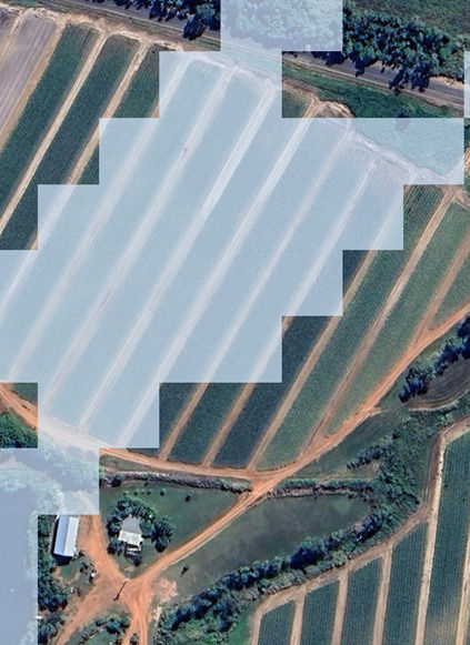
Agricultural loan portfolios differ significantly from standard business and home loan portfolios when it comes to climate change scenario analysis. Properties are typically large, and traditional address-level analysis often overlooks the income-generating areas, such as fields which may be located some distance from the main residence. For example, in Figure 1 the farmhouse itself is unaffected by flooding, but the surrounding fields, which generate the farm's income, are exposed. While the property may not sustain physical damage, flooding is still expected to reduce farm yields and impact gross farm income (GFI).
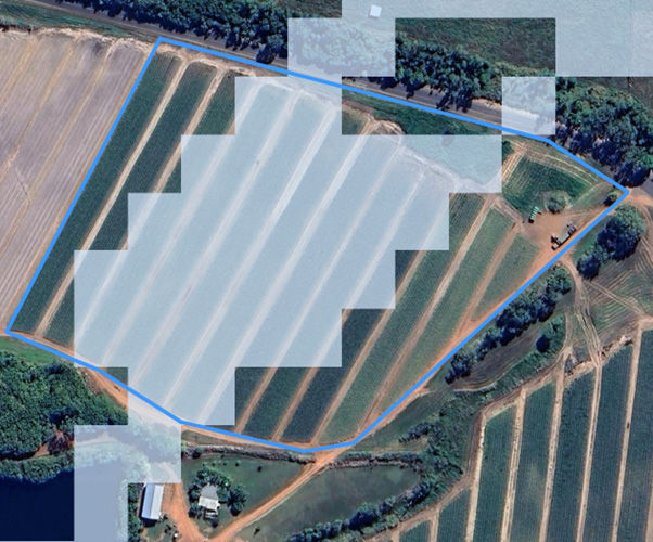
To properly assess risk, we must first delineate the farm area using a georeferenced bounding box that captures both the property and its field boundaries. Figure 2 illustrates this approach, where the bounding box enables a comprehensive evaluation of flood risk—both under current conditions and projected future climate scenarios.
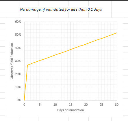
Once the bounding box and flood data have been obtained and analysed, externally sourced loss rates can be applied to estimate the financial impact on the farm. The key drivers of loss include flood depth, duration of inundation, and the type of crop planted. An example of these loss rates is shown in Figure 3. We also work closely with our clients to adjust the rates, as they can vary significantly across regions.
After completing the farm and field-level analysis across the portfolio, results are aggregated and evaluated. An interactive dashboard is then developed, allowing flexible analysis and portfolio insights to support AASB S2 physical risk disclosure and compliance. For more information, or to discuss the specific needs of your portfolio, please contact us at info@climatemappingservices.com.


